
Road-Tripping the Pacific Coast Highway: A Route Overview from Oregon to Southern California

Key Takeaways
- Driving the full PCH from Oregon to Southern California covers roughly 1,000-1,600 miles depending on your exact start and end points.
- Allow at least 7-10 days to experience key stops meaningfully rather than rushing through scenic stretches.
- Northbound drivers gain more ocean-side views; southbound travel puts you on the cliffside lane closest to the drop.
- Seasonal road closures and slides - particularly in Big Sur - can reroute your plans without warning; always verify conditions before you go.
- Coastal accommodations book out far in advance during summer; planning lodging early is essential.
What you will need
Understanding the Route Before You Go
The Pacific Coast Highway is less a single road than a collection of connected state and federal highways - primarily US-101 and California State Route 1 - that hug the western edge of the continent from the Oregon border down to the Los Angeles basin and beyond. Most American drivers frame the journey as starting near Astoria or Cannon Beach, Oregon, and ending somewhere around Santa Monica or San Diego, California.
The total distance varies depending on how strictly you follow the coast, but budget for somewhere between 1,000 and 1,600 miles of actual driving. That number doesn't account for detours to state parks, slow-speed canyon descents, or the hour you'll spend parked at a pull-off watching sea otters float by.
Before anything else, treat your vehicle to a thorough inspection. See our pre-drive vehicle and safety check - coastal driving includes steep grades, salt air, and long stretches between gas stations, all of which surface problems that routine commutes never reveal.
For the full logistics framework - documentation, accommodations, contingency planning - our long-haul trip planning guide walks through every layer of preparation a multi-week drive demands.
What you will need
Segment by Segment: What to Expect
Breaking the route into four broad segments keeps planning manageable and helps you match daily mileage to what each stretch actually offers.
Oregon Coast (Astoria to the California Border)
Oregon's coast is consistently underestimated. US-101 passes through small fishing towns like Tillamook and Newport, past Haystack Rock at Cannon Beach, and through the dramatic dunes of the Oregon Dunes National Recreation Area. Fog is a near-constant companion, especially in summer - embrace it. This stretch rewards slow drivers. Expect roughly 360 miles from Astoria to the California state line.
Northern California (Crescent City to San Francisco)
Once you cross into California, the redwoods take over. Avenue of the Giants in Humboldt County offers a classic detour through old-growth forest. The drive south through Mendocino County delivers some of the most dramatic meeting-of-land-and-sea scenery on the continent. Plan for winding two-lane roads and limited passing zones. San Francisco makes a natural midpoint stop for resupply, rest, and a day of sightseeing.
Big Sur and Central California Coast
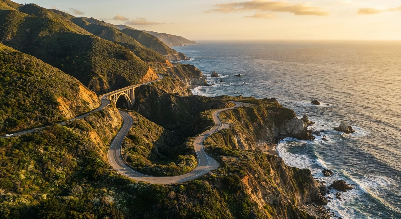
This is the stretch that appears on every PCH poster - cliffside road, crashing surf far below, Bixby Creek Bridge arching elegantly over a canyon. Big Sur is roughly 90 miles long and can take half a day if you stop properly. Check Caltrans road condition reports before entering; slides have closed sections for months at a time in recent years. Point Lobos State Natural Reserve, just north of Big Sur, is worth the state park day-use fee.
Southern California (San Luis Obispo to Santa Monica)
The coastline relaxes into wider beaches and warmer air south of Big Sur. Santa Barbara's Spanish Colonial architecture merits a half-day stop. The PCH through Malibu is slower than it looks on a map - it's a working beach-town road, not a freeway - but that's entirely the point.
Time Your Big Sur Drive for Midweek
Weekend traffic through Big Sur can stack vehicles bumper-to-bumper through the most scenic stretches, turning a meditative coastal drive into a frustrating crawl. Where possible, plan to drive SR-1 through Big Sur on a Tuesday, Wednesday, or Thursday. You'll find easier parking at overlooks and a dramatically more serene experience at trailheads.
How to Drive It Step by Step
Set your direction and timeline
Decide whether you're driving north-to-south or south-to-north. Southbound puts you in the cliffside lane for most of the California stretch, which many drivers prefer for views. Northbound puts the ocean on your passenger side. Either way, budget a minimum of 7 days; 10-14 days lets you explore without white-knuckling the schedule.
Book accommodations early - especially Big Sur
Coastal lodging along the PCH fills months in advance for summer weekends. Campgrounds inside Julia Pfeiffer Burns and Pfeiffer Big Sur State Parks require reservations through the California state parks reservation system. In Oregon, state park yurts and cabins are popular; reserve those through Oregon's system. For cities like San Francisco and Santa Barbara, standard hotel booking timelines apply.
Check road conditions and closures before you depart each day
In California, use the Caltrans QuickMap or call 511 before entering Big Sur or any mountainous coastal segment. In Oregon, ODOT's TripCheck provides current road status. Conditions can change rapidly after rain, and some closures last weeks. Build at least one flex day into your itinerary for exactly this reason.
Fuel up proactively - gaps between stations exist
Between Leggett and Garberville in Humboldt County, and through much of Big Sur, gas stations are genuinely sparse. Fill your tank whenever you drop below half - this is not a stretch where you want to be calculating miles per gallon anxiously. Some stations along the route charge notably more than urban prices; this is a characteristic of the road, not an anomaly.
Identify your must-stop highlights in advance
The PCH has hundreds of pull-offs and overlooks. Without a loose priority list, it's easy to spend all your time in the first quarter of the route and rush the rest. Decide in advance which state parks, beaches, or towns are non-negotiable for you, then fill remaining time spontaneously. Good anchors include: Cannon Beach, the Avenue of the Giants, Point Reyes National Seashore, Bixby Creek Bridge, Point Lobos, and Santa Barbara's Stearns Wharf.
Drive at the pace the road demands
Sections of SR-1 through Big Sur have posted speeds of 25-35 mph, hairpin curves, and no guardrail on the ocean side. These are not suggestions. Slow drivers frustrate locals; aggressive driving on these roads is genuinely dangerous. Use designated turnouts to let faster traffic pass, take your eyes off the view only when stopped, and avoid driving these sections in the dark if you can help it.